Decision to Hike
Due to lack of transportation this summer, I decided to take up hiking to keep in shape. Since I live right across the street from thousands of acres of woods with roads conveniently throughout It just made sense. On weekends I have Sandy to chauffeur me around which worked out well for exploring other options.
Adventures in Backyard Hiking
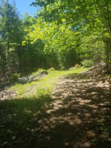
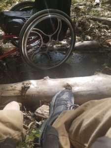
My first attempts at hiking were in the woods that I mentioned. It hadn’t rained a lot, so the ground was quite solid and, for the most part, easy to push on. I picked a trail that the rest of the family had hiked numerous times since they could give me the good beta on what to expect. Of course, they were giving beta from a walking point of view and as it turned out it was a bit harder than I had in mind for the first time out. That being said, it was awesome! I love when things get tough because that’s when its time to think it through and figure it out. The beta that I received said there weren’t many hills and it shouldn’t be too bad. Reality said there was a lot of uphills and a brook to cross. They had mentioned the brook, but no one was quite sure if I would have to cross. I came to the brook and the fun began. It wasn’t very wide. Maybe 3 feet or so but there was an immediate up hill on the other side and log debris scattered in the water. This meant there was no way I could just pull a wheelie and make it across without risk of ending up in the drink as they say. So, I looked around and to the left was a pile of logs that led to a log on the shore. I decided I could just hop over those logs and pull my wheelchair behind me into the water. I could then sit on the log on the other side and pull my wheelchair the rest of the way across coming to rest behind the log I was using as a seat. I just crawled my way up the remaining little bit of a hill and hopped back in my chair. The trail then opens up to a huge opening with another path off to the right or straight ahead leads back to the paved road. This first time I went back to the road, but my second attempt lead me down the path to the right.
Second Attempt
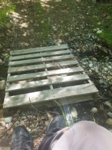
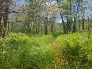
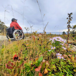
On my second attempt, I used the same method to cross the brook and went off down the trail to the right. For some reason, it never occurred to me that going back toward the brook meant I had to cross it again haha. Luckily this time there was a small pallet bridge. I didn’t quite dare to push across, so I just scooted and dragged the chair behind me. After this crossing, there is a long gradual downhill that leads to a beautiful swampy area. Yes, I know swampy area doesn’t sound beautiful, but it really is. There are blueberries, strawberries, and flowers all around. I could see a path that looked like animals had made right to the berries, so I am glad I didn’t run into any of them eating. After spending a few minutes taking photos and enjoying the scenery and peaceful sounds of the woods it was time to make the push back up that gradual hill. It definitely doesn’t look as gradual sitting at the bottom haha. I did it in a couple pushes and breaks while getting a good workout along the way.
Wells Reserve at Laudholm
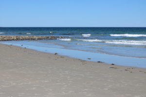
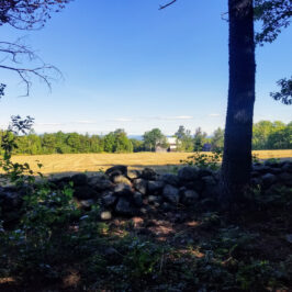
A place we like to go on the weekends every summer is Wells Reserve at Laudholm. This is a beautiful coastal farm that has been preserved with plenty of hiking trails and scenery to enjoy. The path we usually take leads right down to a beach that when the tide is out is super hard packed sand. It is so hard packed I can roll on it with barely a tire mark left behind. It is one of few places I can with almost no help, get down to the ocean. Almost no help meaning I have to navigate some steep stairs and a hundred feet or so of rock before hitting the sand. So, I get Sandy and the boys to help with that part. I know it is doable if I was alone though. The path to the beach is rocky in places with some soft sand but for the most part, is quite easily pushed in a wheelchair. It is also mostly downhill on the way to the beach. Unfortunately, what goes down must come up so it’s a workout on the way back. Well worth the effort for sure.
Greater Lovell Land Trust – Heald and Bradley Pond Reserve
Our most recent weekend hike was at the Greater Lovell Land Trust in Lovell Maine. I had seen this accessibility sign on my way to visit my friend Sean several times and always wanted to check it out. I found it online and after reading the very limited description of the property thought why not. The 802-acre Reserve includes over a mile of shoreline on Heald Pond and over half a mile on Bradley Pond in an area known as Slab City. It is a terrain of forests, streams, hills, and wetlands. The summits of Whiting Hill (801 feet) and Flat Hill (891 feet) and Amos Mt. (955 feet), offer excellent views, including the White Mountains to the west. Heald Pond was named for Benjamin Heald, who built a sawmill here in 1840. Timber back then was the area’s economic backbone. When the sawmills were operating, the “slabs” – the outside cuts of the logs – were piled high along the road, accounting for the name. Evidence of these “shook” and copper mills (where barrels were made to hold the rum and molasses of the Caribbean) is still found at the outlet of Heald Pond. While timber harvesting and milling continue locally, outdoor recreation is gaining an ever greater economic The website has a map brochure, but I couldn’t find any trail descriptions other than what was in the legend of the map. I was able to ascertain that it was an accessible trail and it was .7 miles to the end before it turned into another trail.
The Homestead Trail
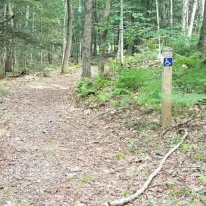
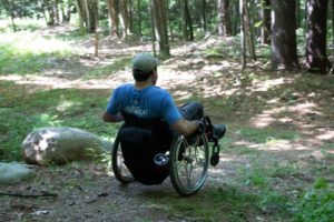 Sandy and I arrived at the sign and turned into a large abandoned parking lot. There were at least 8 handicapped parking posts and no one around. We parked on the opposite side just because I don’t really need to park in accessible parking for the five feet of pushing it would save me. After all, I am there to push myself hard.
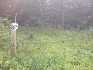 The entrance to the Homestead trail looks overgrown but after starting it opens into what looks like an old logging road. The surface of the trail is very hard packed and mostly smooth. I think that is the only reason they deem the trail accessible. Other than that, it is a full-on workout. Quite steep in places to the point I had to switch back to get up and it is mostly uphill. The scenery along the trail is amazing and as you get higher and higher up you can look back down and see everything you missed on the way by. The trail ends at a small open area with an accessible picnic table. We are going back and will bring a lunch next time.
Red and Blue Trail to Otter Rocks Spur
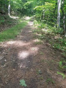
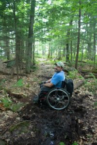
We had dreams of making it a loop back to Heald Pond and then to the road to walk back to the car. After realizing the scale on the map showed .4 miles per inch and the Homestead Trail was .7 we took another look to see how far this loop might be. It appeared to be at least 2.5 miles. We figured we could do that if the trails were doable. Our dreams were dashed when we got about 50 feet into the next trail and realized this was not going to happen without some serious effort by both of us. So we doubled back on the Homestead Trail and decided to check out another area of the reserve that we saw on the map. The Red and Blue trail looked like it would get us down the to water of Heald Pond. We had to drive over to a road called Slab City and near the very beginning is another parking area right on the shore of the pond. This time the trail was not nearly as uphill but the surface had more roots and rocks. I found it a lot more fun as usual haha. We went about a half a mile before coming to the Otter Rocks Spur. This was going to be a challenge and a half haha. The spur is basically a single lane goat path down to the shore of Heald Pond. It is super steep, muddy in places, and lots of bigger rocks. So of course, I said let’s try it and see what happens. I was able to do a wheelie and navigate that way most of the way down. Through the muddy sections, I had to do a combination of bushwhacking around it and mudding. A couple sections I had Sandy stand beside me and hold me from tipping over sideways while I pushed my way through because it was that steep.
The Reward
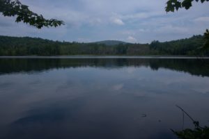
Our reward for all that effort was stunning views of the pond and scenery around the shoreline. There was a lone loon floating about a third of the way across and a cool breeze which felt amazing. We spent a good half hour just taking it all in until we finally decided it was time to work our way back up to the trail. I figured it would take me hours to try to get back up on my own so I relented and asked Sandy to just help push to expedite the situation. It only took us about a half hour to get all the way back out to the back to the car.
My Thoughts
It has been an amazing summer with all the hiking we have done but there is so much more to do. Looking at the map of the area where we live makes me wish we had hiking season all year long. I am seriously contemplating getting a cross-country ski made for this winter and fall weather is here so lots more hiking to come. Check it out next week when I highlight something a lot of you may not know about me and a few people who enjoy the same activity!


Leave a Reply